
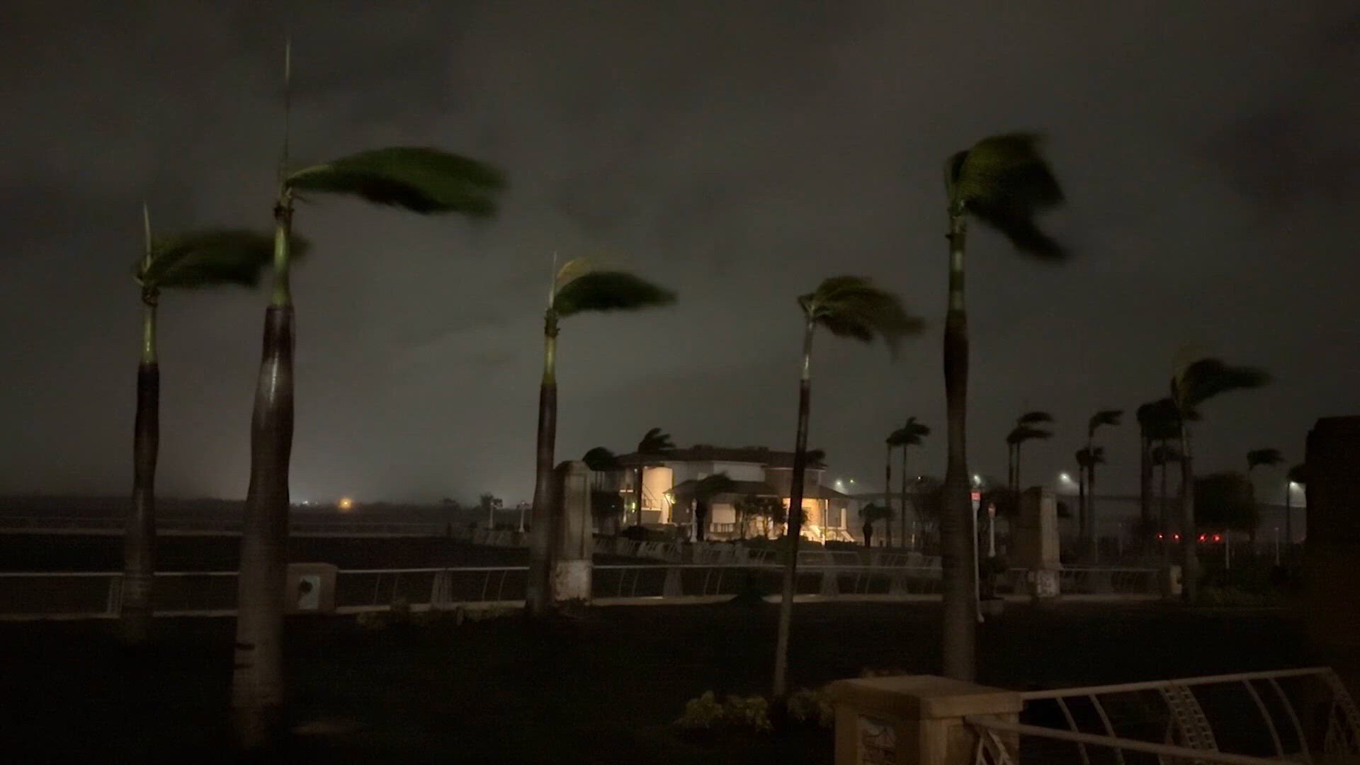
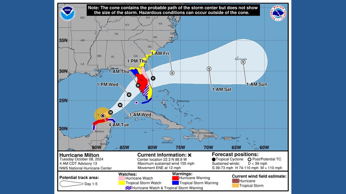
For years, emergency managers and meteorologists have warned that the so-called cone of uncertainty is misunderstood. While it is meant to show the probable track of the center of a cyclone, many assume impacts will only happen inside the cone. However, history has shown us that devastating flooding, tornadoes and storm surge can stretch far outside of it.
Beginning this hurricane season, in an effort to clear up the confusion and better protect inland communities, the National Hurricane Center will start using a revamped cone that includes all land-based tropical storm and hurricane watches and warnings — not just coastal alerts — for the continental United States, Hawaii, Puerto Rico and the U.S. Virgin Islands.
“These improvements empower communities to prepare earlier and more effectively for dangerous hazards from tropical storms and hurricanes,” said Michael Brennan, director of NOAA’s National Hurricane Center.
The changes follow a successful experimental test phase last year that showed people living in inland communities had a better understanding of tropical cyclone wind risks when inland alerts were included directly on the map.
The NHC will also use solid white shading for the entire five-day cone, instead of a dotted outline for days four and five. In addition, it is adding a pink and blue legend symbol that shows where both a hurricane watch and tropical storm warning are in effect.
The cone could get larger
NOAA is also launching an experimental version of the forecast cone that could eventually change the look of the cone.
Since 2002, the cone has been based on circles around forecast points, showing where the center of a storm is likely to track based on historical forecast errors.
The new experimental version replaces those circles with ellipses anchored at each forecast point. Forecasters say the ellipses better account for uncertainty in both the speed and direction of a storm.
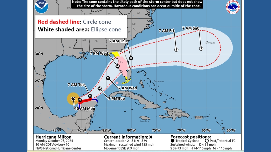
The experimental cone will also expand the area shown at risk. Traditional cones represent about 67% of possible forecast tracks. The new version is designed to capture about 90% of possible storm tracks.
The NHC says the goal is to give communities a clearer picture of how much uncertainty still exists several days before landfall.
The experimental cone graphic will appear on Hurricanes.gov during full and intermediate advisories throughout the 2026 hurricane season.
When it comes to hurricane season, even the best forecasts can be wrong. That's why it is important to be prepared, know your evacuation zone and stay informed at the local level, even if you are on vacation.