
FLORIDA, USA — During hurricane season, there will be a lot of terms used leading up to, during and after the storms. Here's a breakdown of what some of the most common mean:
Advisory
Official information issued by warning centers describing all tropical cyclone watches and warnings in effect, along with details about location, intensity and movement. Advisories also include precautions that should be taken.

Cyclone
This is a blanket term for any area of low pressure that has closed circulation. Hurricanes, tropical storms and tropical depressions are all cyclones because they are closed areas of low pressure.
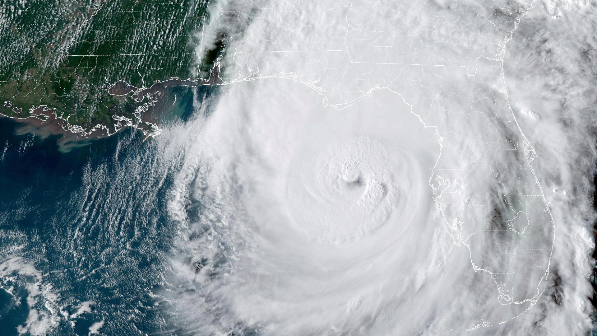
Eye
The roughly circular area at the center of a severe tropical cyclone where the winds are comparatively light. The eye is either completely or partially surrounded by the eyewall cloud.
Eyewall/wall cloud
An organized band or ring of cumulonimbus clouds that surround the eye, or light-wind center of a tropical cyclone. The terms eyewall and wall cloud are used interchangeably.
High Wind Warning
A high wind warning is issued when the following conditions are expected or observed over land: Sustained winds of 40 mph or higher for one hour or more, or wind gusts of 58 mph or higher for any duration.
Hurricane Warning
An announcement that sustained winds of 74 mph or higher are expected somewhere within a specified area in association with a tropical cyclone. The warning is issued 36 hours in advance of the anticipated onset of tropical-storm-force winds.
Hurricane Watch
An announcement that sustained winds of 74 mph or higher are possible within the specified area in association with a tropical cyclone. Because hurricane preparedness activities become difficult once winds reach tropical storm force, the hurricane watch is issued 48 hours in advance of the anticipated onset of tropical-storm-force winds.
Indirect hit
Generally refers to areas that do not receive a direct hit from a tropical cyclone but do experience hurricane-force winds or tides of at least 4 feet above normal.
Invest
Invest stands for "Investigation area". When a tropical wave (see below) gets more organized, the NHC will designate the area of disturbed weather as an Invest. Each Invest is giving a number from 90 to 99. Each Invest is also given a letter. The record number will cycle between 90 and 99, so you may see multiple systems with the same number throughout a season. The basin indicator represents which basin the weather originated from. "L" denotes the Atlantic basin, while "E" indicates a system in the eastern Pacific.
Hurricane/typhoon
The only difference between the terms is the location in which they occur. The term hurricane is used for Northern Hemisphere tropical cyclones east of the International Dateline to the Greenwich Meridian. The term typhoon is used for Pacific tropical cyclones north of the Equator west of the International Dateline.
Storm surge
An abnormal rise in sea levels accompanying a hurricane or other intense storm creating a life-threatening situation.
Tropical depression
A tropical cyclone in which the maximum sustained surface wind speed is 38 mph.
Tropical disturbance
A generic term for discrete weather systems that originate in the tropics or subtropics and maintain their form for 24 hours or more.
Tropical Wave
An unorganized area of storms traveling west out of Africa. About 85% of major hurricanes begin as tropical waves.